レイアウト: 情報欄あり

Nakatsukuni Mid-Earth Park
Flood channel park
Location : Inakusa, Souryo-cho, Shobara-shi, Hiroshima
Total area : Approximately 125,000㎡
Completion : 2007
As suggested by its original name "Inakusa (rice-grass)," fertile rice fields formally spread throughout the area. The fine waters of the Tabusagawa River, exactly as implied by its name (Tabusa = gross field), brought rich crop of rice to the land. This rich and beautiful rice field scenery vanished by the construction of the Haizuka dam, and became transformed into a wasteland by the name of reservoir (riverbed). Alternative proposals for the area (including a productive utilization plan) from the local citizens were developed in workshops lead by Okazaki, and submitted tenaciously over the span of more than ten years. The different versions of proposal revised through the negotiations and adjustments with the Ministry of Land, Infrastructure and Transport and government extend to vast numbers.
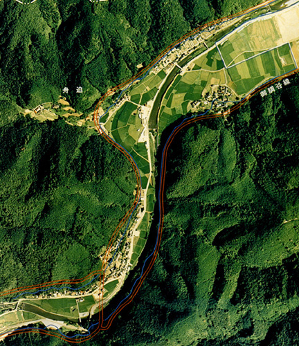

left:Inakusa district where rich rice fields expand
right:initial plan (image of natural construction method)
As a result of this long process, their proposal was finally accepted in 2004, and became realized as the Nakatsukuni Park in 2007.The flow of Tabusagawa River, which was made to run straight for water control reasons in the Meiji era, was restored in its original curving form as an underflow. 'Wandos' and Streams where fireflies inhabit were built throughout the park, with consideration to make the place a rich inhabitation environment for all creatures.
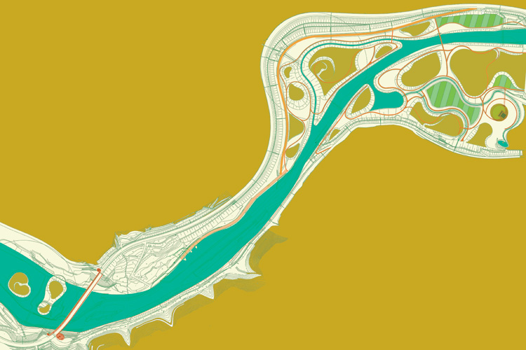
finalized plan
The landform of the area is composed by superposition of hills or planes of moderate elevation between 1 to 5 meters (8.5 meters at maximum) of height, each differing in its direction of inclination. Various plateaus of different inclination angle dart in and out of sight like leaves falling on top of each other as one walks around, each time modifying the view and changing the continuity of the scenery.
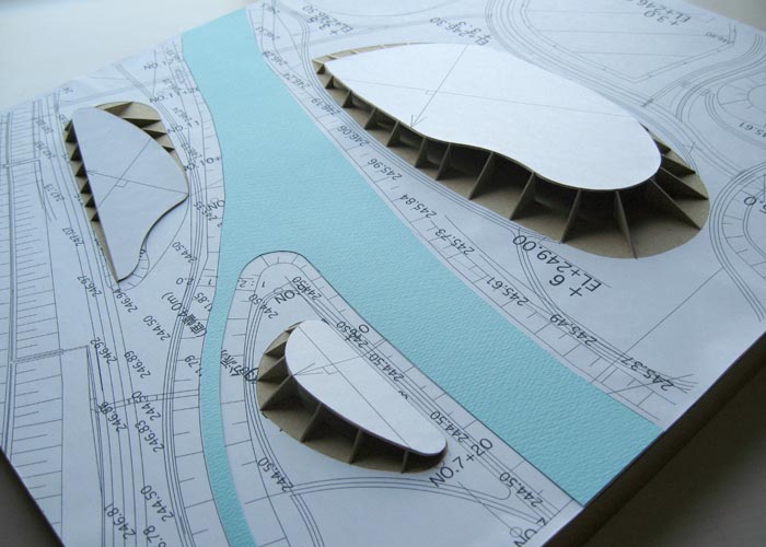
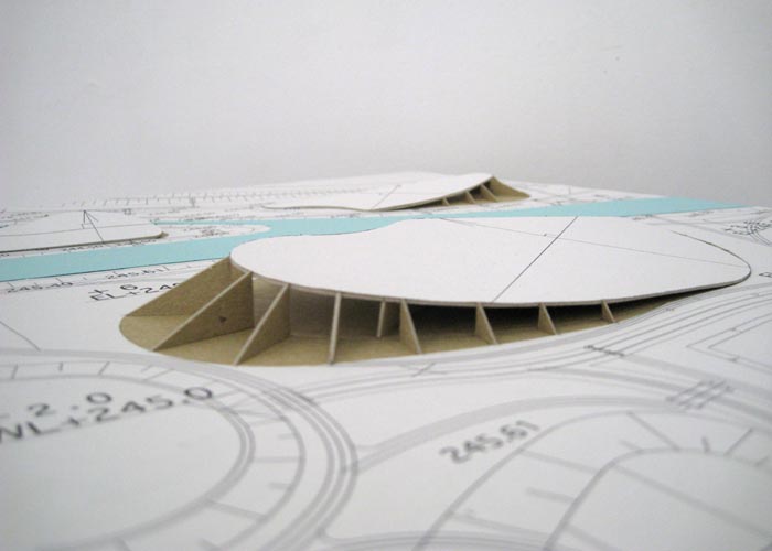
model of longitudinal level study
Twenty kinds of maple trees, sixteen kinds of acorns and fifteen kinds of fruit tree, along with fields of rapeseed and herbs color the park. The lagoon make a perfect fishing spot not only for anglers but also for wild birds (many wild and migrating birds have already visited the park, making it a paradise of birds). In this park the activities of people (likewise to other creatures) are also incorporated as one part of the larger cycle of nature. It is in between such fold or relief woven by nature that the gross field of Tabusa, the lost rice paddy which all citizens wished for, were to be finally resurrected.
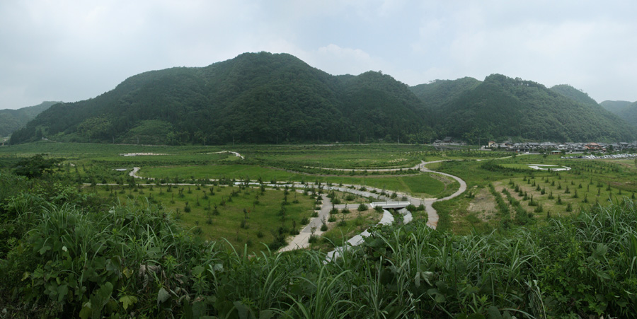
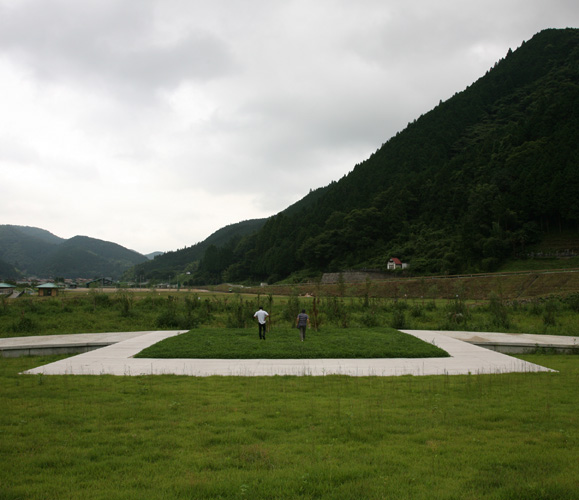
shortly after construction
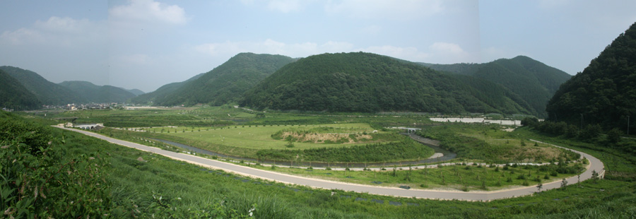
shortly after construction
The name of Nakatsukuni park derives itself from the old tale that the towhead ("nakatsukuni") of the river became the center from which the country was born ("nakatsukuni"), the origin of fertility (In English, this can be translated as Middle-earth, the name of the land which formed the setting of J.R.R Tolkien's Lord of the Rings). To make the towhead of Tabusagawa River which runs through the Chugoku mountain area and where rice grows as abundantly as grass the starting point for environment creation, is the hope and pride conveyed in this name.
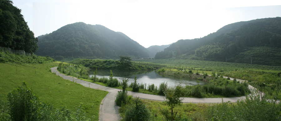
shortly after construction