
About Haizuka Earthworks Projects
1, Background
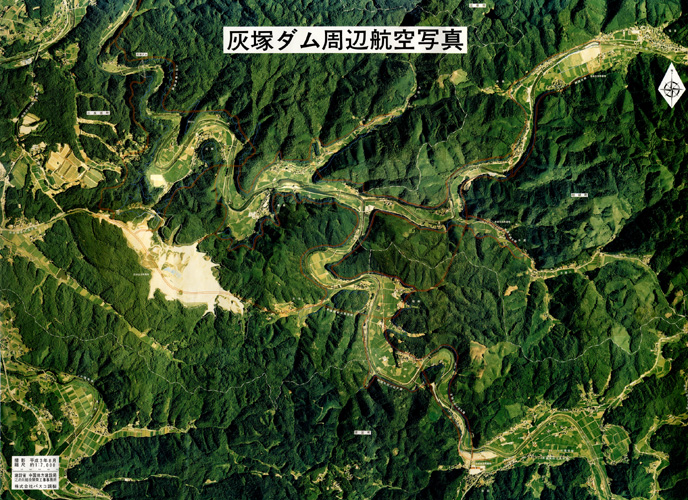
In 1965, a plan was announced to build a flood-control dam in the rural mountain district of Hiroshima prefecture. Due to frequent flooding, the Gonokawa River, also known as the Rough River, required a flood-control dam. The area planned for the dam construction was a valley region of four square-miles (4144 hectares), crossing over the three towns of Mirasaka, Kisa and Soryo, located in the southern part of the Chugoku mountain area, about 40 miles northeast of Hiroshima city.
The requisitioned land for the dam lake (half of which was to be reserved as flood-control, normally remaining above the water line) was a vast region mainly used for agriculture. Villages were scattered around this area, and the construction of the dam would drastically change not only the natural environment but also the rich local culture which had formed in relation to the abundant natural resources. Thus, a strong opposition movement against the construction of the dam naturally arose from the local citizens.
However, in addition to the great flood disaster of Gonokawa River of 1972, the continuous battering of the local economy and its declining population made the dam construction unavoidable by the mid-1980s. The dam was finally accepted under the condition that it would disclose its construction process on a yearly basis and hold discussions to take proposals from citizens into consideration, thus reaching mutual agreement. In 1993 a working group (called the Haizuka Earthworks Projects) was formed, consisting of local citizens and a number of artists and architects such as Kenjiro Okazaki, as an organization to create proposals to minimize the damage to the natural environment and local culture caused by the dam construction.